Log in
All resources
Create a design
864 Free Images of Gemeente Musea
gemeente atlas van nederland - north holland
1860s maps of north holland
gemeente atlas van nederland - south holland
1860s maps of south holland
media from regionaal archief alkmaar
old maps of sluis
maps of polders in zeeland
gemeente atlas van nederland - zeeland
musea brugge
ink
maps of polders in zeeland
old maps of sluis
maps of polders in zeeland
old maps of sluis
gemeente atlas van nederland - north holland
maps of wognum
gemeente atlas van nederland - south holland
1860s maps of south holland
gemeente atlas van nederland - north holland
maps of avenhorn
gemeente atlas van nederland - north holland
maps of spanbroek
gemeente atlas van nederland - north holland
maps of schellinkhout
gemeente atlas van nederland - north holland
maps of middelie
gemeente atlas van nederland - north holland
maps of wijdewormer
maps of polders in zeeland
old maps of sluis
gemeente atlas van nederland - south holland
1860s maps of south holland
gemeente atlas van nederland - north holland
maps of krommenie
gemeente atlas van nederland - south holland
maps of wassenaar
gemeente atlas van nederland - north brabant
maps of oss
gemeente atlas van nederland - south holland
1860s maps of south holland
gemeente atlas van nederland - north holland
maps of hoogwoud
gemeente atlas van nederland - north holland
maps of ilpendam
gemeente atlas van nederland - south holland
1860s maps of south holland
gemeente atlas van nederland - north holland
maps of texel
gemeente atlas van nederland - south holland
maps of veur
gemeente atlas van nederland - north holland
maps of landsmeer
gemeente atlas van nederland - north holland
maps of twisk
gemeente atlas van nederland - south holland
1860s maps of south holland
gemeente atlas van nederland - south holland
1860s maps of south holland
gemeente atlas van nederland - north holland
maps of venhuizen
gemeente atlas van nederland - north holland
maps of opmeer
gemeente atlas van nederland - north holland
maps of midwoud
gemeente atlas van nederland - north holland
maps of opperdoes
gemeente atlas van nederland - north holland
maps of urk
gemeente atlas van nederland - south holland
1860s maps of south holland
gemeente atlas van nederland - north holland
maps of bovenkarspel
gemeente atlas van nederland - north holland
maps of oudendijk
maps of polders in zeeland
old maps of sluis
gemeente atlas van nederland - north holland
maps of wormer
gemeente atlas van nederland - south holland
1860s maps of south holland
gemeente atlas van nederland - north holland
maps of uithoorn
gemeente atlas van nederland - north holland
maps of bloemendaal
gemeente atlas van nederland - north holland
maps of oosthuizen
gemeente atlas van nederland - north holland
maps of uitgeest
maps of polders in zeeland
old maps of sluis
gemeente atlas van nederland - north holland
maps of berkhout
gemeente atlas van nederland - north holland
maps of vlieland
gemeente atlas van nederland - north holland
maps of obdam
gemeente atlas van nederland - north holland
maps of sijbekarspel
gemeente atlas van nederland - north holland
maps of westwoud
gemeente atlas van nederland - north holland
maps of zandvoort
gemeente atlas van nederland - south holland
maps of maassluis
baroque painting,baroque
musea brugge
gemeente atlas van nederland - north holland
old maps of alkmaar
gemeente atlas van nederland - south holland
1860s maps of south holland
media from regionaal archief alkmaar
oudkarspel
media from regionaal archief alkmaar
oudkarspel
harness racing in art
musea brugge
horse sleighs in art
musea brugge
gemeente atlas van nederland - south holland
1860s maps of south holland
gemeente atlas van nederland - south holland
1860s maps of south holland
gemeente atlas van nederland - south holland
19th-century maps of rotterdam
gemeente atlas van nederland - south holland
1860s maps of south holland
gemeente atlas van nederland - south holland
maps of hellevoetsluis
gemeente atlas van nederland - south holland
1860s maps of south holland
gemeente atlas van nederland - south holland
1860s maps of south holland
gemeente atlas van nederland - south holland
1860s maps of south holland
gemeente atlas van nederland - south holland
old maps of dordrecht
zeist in the 19th century
maps of zeist
gemeente atlas van nederland - south holland
old maps of leiden
gemeente atlas van nederland - north holland
old maps of haarlem
gemeente atlas van nederland - north holland
maps of marken (waterland)
gemeente atlas van nederland - north holland
old maps of monnickendam
gemeente atlas van nederland - north brabant
old maps of veghel
gemeente atlas van nederland - south holland
old maps of gouda
gemeente atlas van nederland - north holland
old maps of enkhuizen
gemeente atlas van nederland - north holland
old maps of beverwijk
gemeente atlas van nederland - south holland
old maps of delft
gemeente atlas van nederland - north holland
old maps of haarlem
gemeente atlas van nederland - north holland
old maps of purmerend
gemeente atlas van nederland - south holland
old maps of gouda
adolphe d'hastrel
musea brugge
media from regionaal archief alkmaar
zijpe
media from regionaal archief alkmaar
limmen
media from regionaal archief alkmaar
schermerhorn
media from regionaal archief alkmaar
schoorl
media from regionaal archief alkmaar
scharwoude
media from regionaal archief alkmaar
oterleek
gemeente atlas van nederland - gelderland
maps of ophemert
1866 in the netherlands
maps of almelo
collection cartographic documents from het utrechts archief
gemeente atlas van nederland - utrecht
gemeente atlas van nederland - gelderland
netherlands in the 1860s
gemeente atlas van nederland - limburg
19th-century maps of maastricht
media from regionaal archief alkmaar
zuidschermer
gemeente atlas van nederland - south holland
1860s maps of south holland
old maps of amersfoort
hoogland
gemeente atlas van nederland - north holland
old maps of haarlem
maps of made, north brabant
maps of drimmelen
collection cartographic documents from het utrechts archief
gemeente atlas van nederland - utrecht
romanticism,orientalism
musea brugge
collections of the stedelijk musea, sint-niklaas
basile de loose
gemeente atlas van nederland - north holland
maps of haarlemmermeer
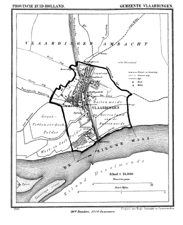
gemeente atlas van nederland - south holland
old maps of vlaardingen
gemeente atlas van nederland - south holland
maps of heerjansdam
gemeente atlas van nederland - south holland
1860s maps of south holland
501 - 600 of 864
Next page
/ 9